Day 8
Well if life was good yesterday, it was even better today! After an omelette for breakfast, lovingly cooked by Lyn the King of Omelettes, we had another long day of driving on the E4, but passing some amazing views.
Lyn did his usual trick of finding us the most perfect stop for lunch, right by the side of a tiny little harbour. It was the most peaceful, picturesque place imaginable.
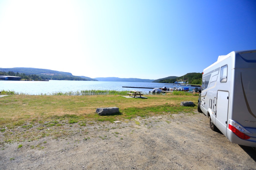
I could have stayed there forever, or at least until winter came! We ate our wraps out on a picnic bench, just soaking in the view. Then, it had to be done! I had promised myself if I came across the right spot I was braving the cold water, and going swimming. I got changed, then headed down the steps off the jetty and into the sea. It was cold. It was Baltic in fact, but boy, it felt good!
I got back out, and we got talking to a couple who were loading wood off their trailer onto their little boat. Lyn ended up helping them. They were taking the wood over to their little cottage on a neighbouring island, to build decking. Their cottage has no water or electricity. Sounds idyllic, with amazing views.

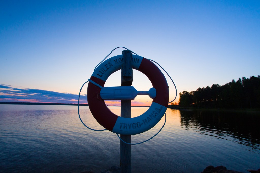
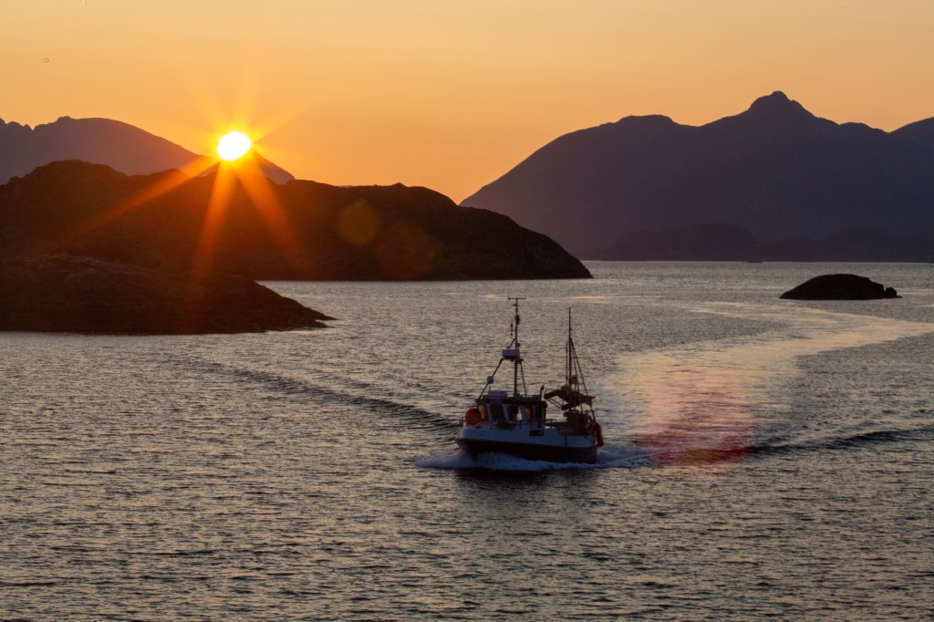
We then headed up into Lulea, where we planned to stop for the night. We had a quick T shirt buying stop at another Harley Davidson dealership and then found another free parking spot right on the edge of the water, where the sunset is incredible. We walked into the town centre and stopped for coffee and cake, sitting outside as it is a really pleasant 21 degrees; my type of temperature at last! We then wandered around the town, calling into a few outdoor pursuit shops, but not buying! We loved walking around the marina, and watching the ferry come in from cruising around the Lulea archipelago. We were fascinated by 3 massive tugs docked out. Luckily we came across a big noticeboard explaining (in English and Swedish!) that they were ice breakers; their role is to ensure that commercial shipping routes are kept clear during the winter months as the Baltic freezes over, the ice is up to several metres thick in some places. The statistics were amazing and only emphasises their sheer strength and power, for example their lights are so powerful you can read a newspaper from their light a mile away! It was also interesting to see how much of the Baltic freezes; in a severe winter it can freeze as far down as Stockholm and Copenhagen.
Dinner was defrosted Homity Pie from our freezer, and we ate outside. It is another big driving day tomorrow, and we need to stock up in a Swedish supermarket before we get to expensive Norway!
It is our last night in Sweden, and I am quite sad; I have loved it here. It is a beautiful country, with good roads and so many trees and lakes. In fact over 2/3 of Sweden is covered by forests, and there are over 95000 lakes. Swedes love nature so much they are one of the few countries in the world where every person has the “freedom to roam in nature”. Swedish music is one of its biggest exports and it was the first country to ban smacking! One final fun fact to leave you with is that Sweden sends invoices to North Korea every year as Kim Il Sung ordered 1000 Volvo cars which he never paid for in 1974. North Korea now owes Sweden 2.7 billion Swedish Krones. Reckon they’ll get it??
Day 9
We left lovely Lulea, and had to make a decision. Do we go straight to Narvik (Norway) and then onto Senja, or do we divert and nip into Finland and follow the River Torne up?
We decided on the most adventurous route, albeit a little longer. Lyn has been to Finland twice in winter, to Helsinki with work, but this was to be my first time.
We stopped at the Swedish border town of Harparanda, where there was a huge Ikea! We had a quick Max burger, and called in two outdoor pursuits outlet shops but couldn’t afford anything! We could see a lot of activity in one shop so we wandered over to see what it was. It was a shop selling alcohol, and the car park was full of Finnish cars, obviously shopping for cheaper booze. We didn’t buy anything as it was still quite expensive and we were worried about being over the strict customs limit to enter Norway, plus the queues were huge!
Crossing the border was easy, we just drove across a short bridge across the Torne into Tornio in Finland. The Torne acts as the border between Sweden and Finland and is 354 miles long. It is the largest free flowing river in Europe, and because most of it flows above the Arctic Circle the sun never sets on it around midsummer.
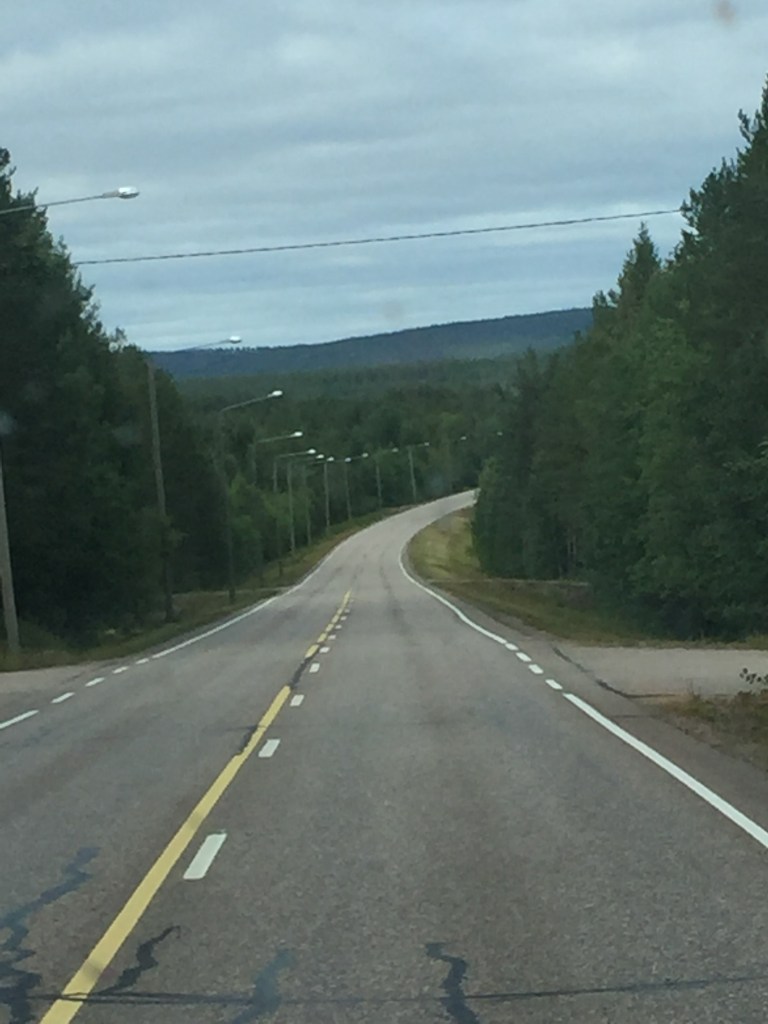
We just drove, and drove and drove! We took every opportunity to fuel up, mindful of the cost in Norway. The roads were empty and the scenery spectacular. There was, however, one major hazard, the amount of reindeer wandering about on the road! We saw loads and had to either slow down or come to a stop completely to wait for them; it is their home after all! Slowly the scenery changed as we gained height, from millions of trees to fairly plain tundra. At one point we were over 2000 feet in height, the temperature had dropped to 7 degrees and there was snow on the mountains.
We stopped at an idyllic little beach at the river for a rest. It was beautiful and I could have stayed there longer.
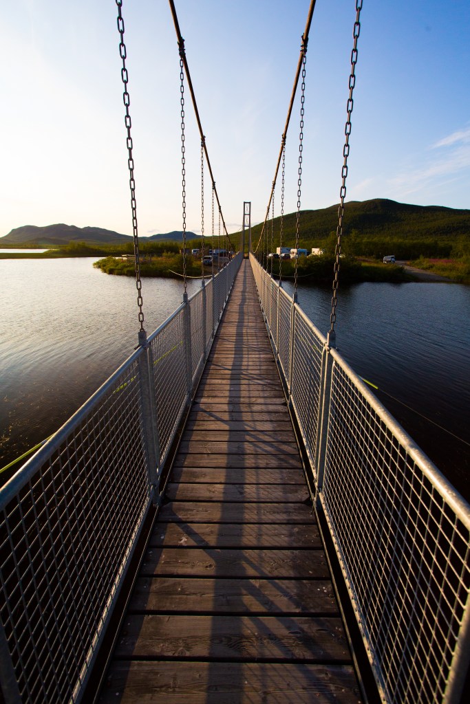
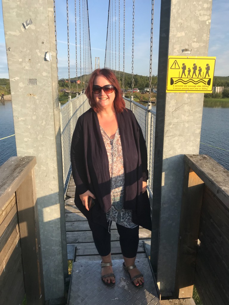
We drove on and Lyn took us to a spot he had visited before with his friend Phil when he did the Tromso Midnight Sun Marathon. It is basically a tiny bridge you can walk across the Torne to Sweden. It is very rickety and right in the middle of nowhere. It is obviously used by fisherman and wilderness junkies to access huge areas of wilderness in both countries. There are not many bridges across!
We stopped to watch the sunset, and I cooked dinner; puy lentils with soya yogurt and avocado, with salmon. Not particularly Instagram worthy, but it was fast and tasted good. The view through the van windows was amazing, but so were the mosquitos!
It was now time for the final push; and to navigate the Norwegian border and customs without looking too guilty! They have very strict alcohol limits, and we have very strict alcohol needs! Luckily we sailed straight through, with no sign of anyone official. It was late at this point; and we realised there was a time difference between Finland and Norway. Finland was an hour in front (GMT +3) whereas Norway was GMT +2. It was about 11pm by the time we got to our wild camping place, but still full daylight. I was just glad to get to bed, it had been a long day.
Day 10
Lyn had found his way back to a waterfall he had visited with Phil a few years ago. We parked on an old bridge over the waterfall, so in effect the waterfall went beneath us all night long. I was past caring at this point; I just wanted my bed. I passed out, with the sound of the waterfall in the background.
All too soon it was morning. Lyn was up before me and had been taking photos of his beloved waterfall.
We were soon on the road, towards the next step on our journey; the island of Senja. Senja is north of the Lofoten islands, and is the second biggest island in Norway. I had high hopes for it, and expected it to be much quieter than the Lofotens.
The journey there was spectacular. It was good to see my first fjord, but there were many many more to come! The sea is incredibly blue, and the mountains rather large! Add this to some spectacular little towns perched on the water’s edge, and you could stop and take photos every other minute! We stopped at a rest stop, and were amazed to find a machine that empties our chemical loo! Wow, just wow!
We soon got to Finnsnes, at the gateway to Senja. Typically there was a market in the streets, so the sat nav took us through all the back roads. We stopped in our first Norwegian supermarket. Ouch! Four pounds fifty for a nice loaf of bread?? We crossed the bridge into Senja, and followed Tourist Route 82 twisting and winding our way towards our first stop; the spectacular village of Husoy.
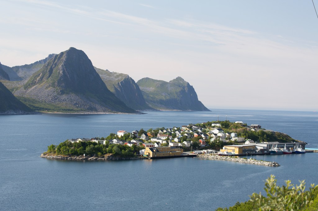

Husoy is a tiny islet which is home to Senja’s most active fishing community, with just a few hundred permanent inhabitants. Until a few years ago it could not be reached by boat. It made for some incredible photos.
There were many tunnels on Senja; our first experience of Norwegian tunnels! Wow, some were a mile long, and quite rough and ready.
We eventually arrived at where I wanted to spend the night. Luckily my expectations lived up to reality, and I wasn’t disappointed. We stayed right on the beach at Ersfjord, and when I say right on the beach, I mean right on the beach! Lyn was in his element watching the Norwegian in front of us getting towed off his sandy spot in his motorhome! Luckily, Lyn had chosen our spot with care and we had no problems. He’s the man! I cooked a Malaysian chicken coconut curry and rice for dinner, and we settled in for the night with this awesome view.
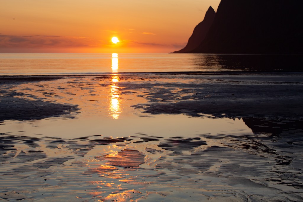
I could have looked at the view all day….. and all night! The sun didn’t set until about 11.20pm, and then rose again about 2.30, so it never really got dark. I went and sat on the beach to watch the sunset; it was breathtaking.
Day 11
We left Ersfjord quite late; we couldn’t tear ourselves away from the view! We drove up Route 82 and stopped after a few minutes at the Tungenset viewpoint. Norwegians take their viewpoints very seriously, and they are usually quite artistic in design.
We walked along the wooden pathway, and onto the big rocks and just stood, taking in the view.
We then drove on to Gryllefjord, to catch our ferry to our next place, the Vesteralen. Catching a ferry in Norway can be both fraught and relaxing, often at the same time. First, you have to decipher the Norwegian timetables. Then you have to get there, whilst estimating just how early you have to be there to actually get on. Then, you play the waiting game, which is the relaxing part. Once your van is in the queue, and within the embarkation lines, you know you have nothing to do but chill and wait.
We wandered around the little port in the sunshine, taking in the views, and I read my kindle till it was time to drive on. We were soon up on deck for the 100 minute long ferry, watching the coastline as we sailed.
Lyn had used the app on his phone to buy our ticket, only to find out it expired two minutes before we were due to sail! We needn’t have worried, as you don’t buy your ticket until you are nearly half way across and they open the window. It’s very much an honour system, with not many checks in place!
We were soon driving off the ferry, and headed towards the office of the company we were due to do a whale watching trip with on Tuesday, just to check on things. It was a good job we did; the sea conditions were not good, it was very windy out at sea and they were about to cancel that night’s trip. We decided to ring in the next day to check on ours, but the forecast did not look good.
We drove to the campsite I had earmarked. We have loved wild camping, but it was time to do some laundry! We checked in, and found our spot. Lyn, as ever, found the most perfect spot there. Not playing it safe like most of the camper vans there, he drove to the top of a mound and we had an absolutely million dollar view out over the sea and the islands. We even had our own little access down onto the sandy beach.
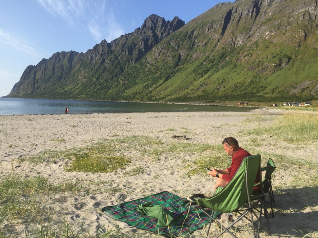
We had to go for a beach walk, me being ever classy, with a can of Swedish blackberry cider. The sand was amazingly fine, and the sea the most beautiful turquoise blue. There were quite a few jellyfish washed up; some amazing orange ones, and other lilac ones. I had a little paddle, then it was time to go and eat.
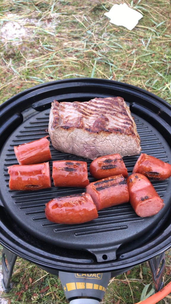
It was time for our first BBQ, so Lyn braved the cold, and sat outside barbecuing some steak.
There wasn’t much of a sunset tonight as it had clouded over, but it was still light till gone midnight. It just doesn’t get dark at all, which has played havoc with our sleeping!
Day 12
Today was a very late start again! These late nights are taking their toll. I miss the dark!
We ended up having a very chilled day, with me mostly catching up on my blogging. We rang about our whale watching trip at lunch time, to find out it had been cancelled. We were disappointed, but not surprised. I had looked forward to seeing the whales close up from a Rib, but it was not to be. You can’t fight the weather! They had cancelled all trips until at least Thursday, but we simply couldn’t hang about till then.
We eventually left our fabulous view at about 3pm, to drive into the Lofoten Islands for the first time.
We were heading to Svolvær, which is the biggest town in the Lofotens, and therefore it’s capital, even though it is tiny, with a population of less than 5000.
We got there, and parked in a dusty car park in a construction area for the night. It is a completely different view to the last couple of nights, but we needed somewhere to leave our van safely as we have booked a kayaking trip tomorrow!
We headed into Svolvær at about 8pm to have a look around. It is typically Norwegian, where life is very definitely centred around the sea, but there is a definite touristy aspect to the place too. We wandered around, and then back to the van. Pasta and pesto for dinner, and then time to get ready for our early start tomorrow.
Day 13
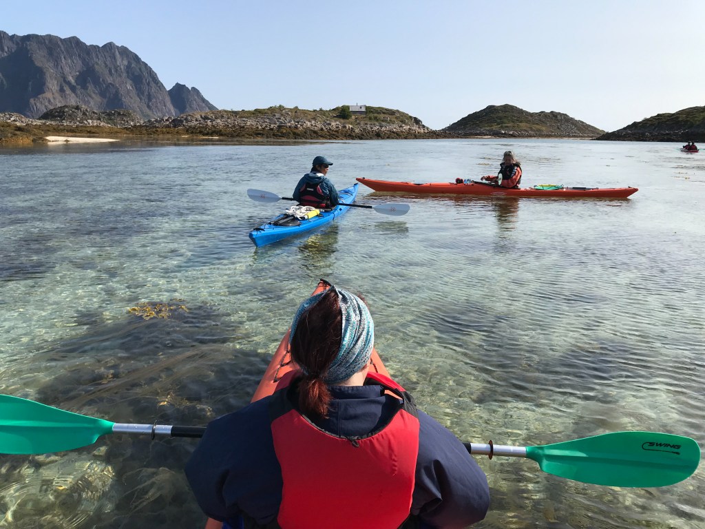
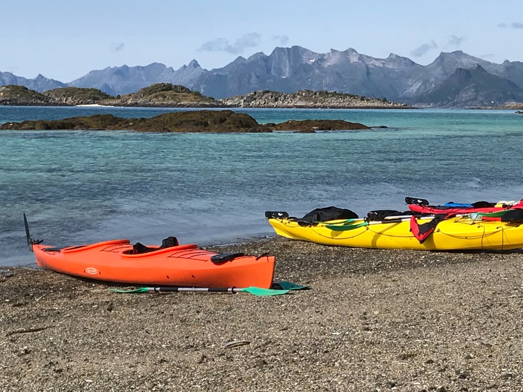
Early start for us this morning; it was going to be a big day! We were up at 7.30am and walked the 10 minutes or so into the centre of Svolvaer ready to meet our kayaking trip. Already the little gremlins of doubt were playing in my mind…..was I dressed warmly enough? Would I be too cold? Would I be able to get into the kayak easily? Would I be able to get out?? Yes, we had done kayaking in Stockholm, but this was to be a very different type of trip, as it was a guided one, along with another 10 people. It’s ok looking stupid when it’s just me and Lyn (he’s used to it!) but this would be very public! Never mind, out of my comfort zone again, and nowhere to hide.
We met up easily enough and were soon on a little boat heading out to sea for 15 minutes or so to the island of Skrova. This was to be my first challenge; stepping down off the high jetty into the boat. Not easy with little legs, but I did it. Hey, I may not have looked elegant, but I was in the boat, in our individual swivel chairs and with our life vests on.
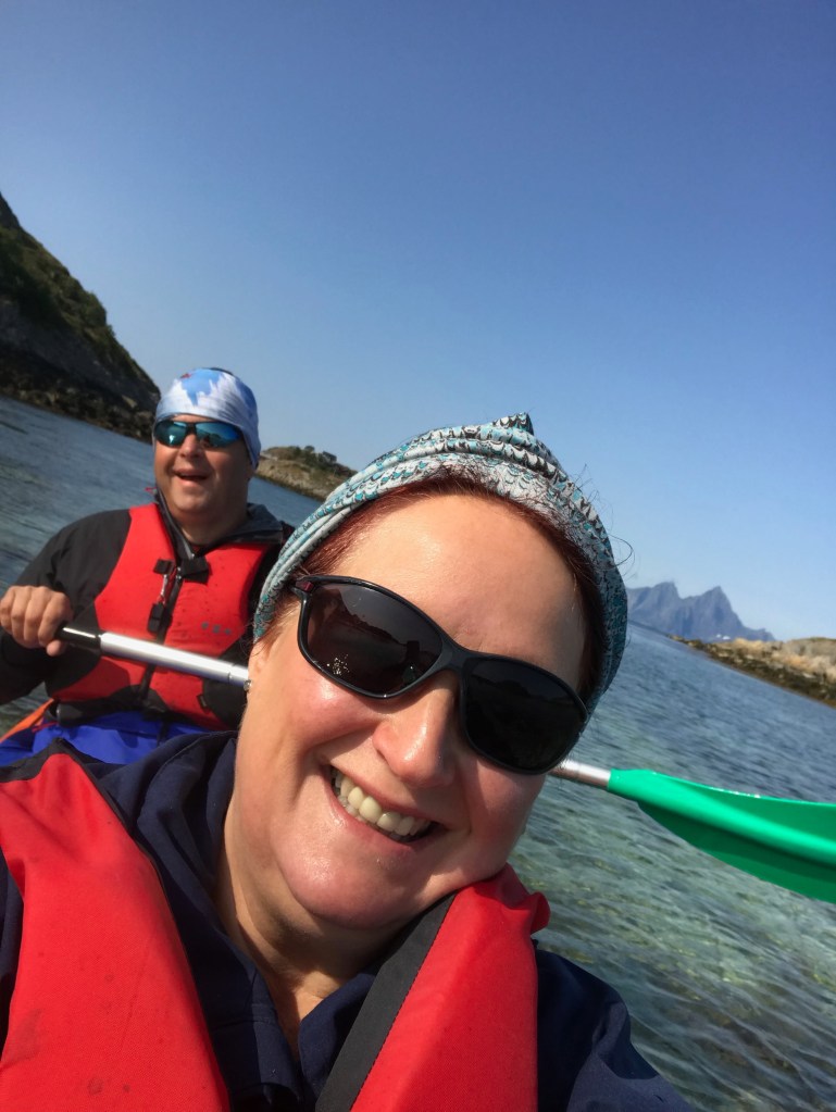
We got to Skrova, and were met by our two guides; an amazing Australian woman and an equally amazing Malaysian man. They talked us through everything we needed to know, and quickly worked out Lyn was the tallest person, so guess who was in the biggest kayak? Yup! We tried it out on land, but there were still problems getting Mr Long Legs in the bloody thing; to the extent that he couldn’t use his legs to use the rudder. So, in effect we were going to be rudderless! This was not going to be an easy kayaking trip as the rudder steers the bloody thing! It would all have to be steered by paddling.
We got suited up, and my carefully chosen colour coordinated outfit (all blues) was soon hidden beneath a bright blue spray deck, under a red life jacket and in an orange kayak. What can I do? One tries!
Next came the big hurdle; getting into the kayak off a jetty. Lyn was to be the rudder in the back of the double kayak, and I was the “engine” in the front. (Stop laughing!) I managed to get in easier than I thought. Yay for me!
We were soon paddling around in the protected calm bay, but then headed out to open sea. On the way there we passed through some amazingly shallow clear water. It was amazing to look down and see jellyfish. The guides pointed out dead sea potatoes and sea urchins, and we got to spot two sea eagles that seemed to follow us for our journey. Amazing.
The kayaking was pretty easy at this point, but we soon had to cross two open sea channels which proved a bit more challenging. One word; waves! Not your friend when you are in a pointy narrow little thing on the ocean. My arms were soon tiring, but we plodded on, and eventually reached a beach on the island of Litlmolle. Getting out was easier than I thought, even if it did involve a slightly wet foot!
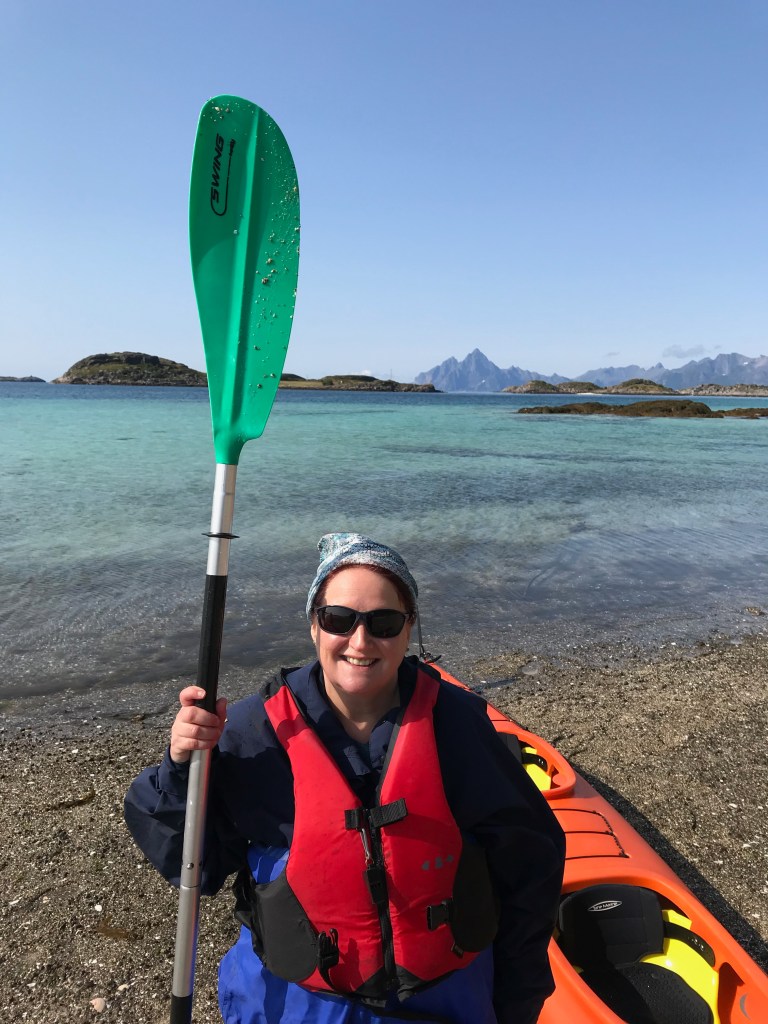
We had chosen this trip because of what it promised, and it didn’t disappoint. This was the “little Hawaii” kayaking trip where we were promised deserted beaches and tropical blue seas. That is exactly what we got. It was absolutely beautiful; hence loads of photos. Sorry not sorry! We stayed about 30 minutes there and ate our lunch. Getting back in the kayak was easy, although I forgot our kayak had a mega pointy nose and tried to walk through it rather than around it! Mega ouch! I saw stars and had a swollen bruised leg to prove it.

We had guessed that going back would not be easy, and this was soon proved right, when our guide gathered us together to talk through the return using a piece of seaweed to represent the wind, and a shell to represent the waves. It all sounded rather complicated. The waves were going to be sizable and coming from behind us, in a different direction to the wind. We were told not to “surf the waves” as we would shoot off like a rocket and the wind would turn us. We also needed to be not broadside to the waves or we would capsize. The instructions included a lot of instructions to back paddle at certain times, but I think I tuned out due to fear! Ignorance is bliss, right?? Of course we were at a disadvantage to start, with no rudder. OMG, what have I let myself in for?
We were soon paddling across to the pen channel. So far so good. Then we hit the waves. Bloody hell. Life flashed before my eyes. There was no time to think, or rest my tired arms. The little engine had to keep going, while Lyn tried to steer a straight line whilst keeping the correct angle to the waves. It was fraught at times, and we seemed to be paddling like mad, but not actually getting anywhere.
After an eternity, we got into the shallow waters again and breathed. We weren’t the only ones struggling, everyone found it challenging, but the guides were amazing and we felt in safe hands.
We bypassed the sea plane with my name on it, and we were back at the jetty, after 7 miles kayaking. Now for the next hurdle, getting out of the kayak when you have used up every last little bit of energy, and your arms and legs don’t work! I managed to get out and onto my bum, then struggled to get to my feet!
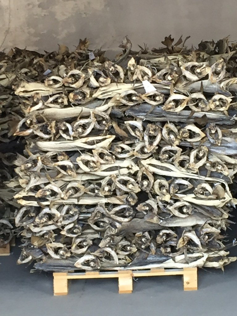
We had a ten minute walk to the boat to go back, through a tunnel in the rocks. Ingeniously they have lined the tunnel with old photos of the island and its inhabitants. It was fascinating. Skrova is only reachable by sea, and it is one of the key places for fishing in the Lofotens. Rumour has it Skrova has the highest concentration of millionaires in Norway due to fishing! It used to have eight fishing factories but now has only one. We could smell and see the cod drying from our kayaking dock. The guides told us of how children as young as six would spend their summer holidays in the factories cutting the tongues out of the cod; apparently it’s a delicacy?
We had an uneventful boat trip back to Svolvaer, and we soon back at the van. A quick shower and change and we were on our way up to Henningsvaer, where Lyn wanted to see the infamous football field, hewn out of rock at the end of the island. It was a busy drive; it is definitely a lot more touristy here with a lot more cars on the road. We saw the football field then drove back to find a camping spot for the night. Lyn used his magic powers to find another perfect spot, where we parked up to chill and watch the sunset. I was so knackered at this point I needed a nana nap, so spent a happy hour sleeping. The sunset views over the mountains are as spectacular as ever, but bloody hell I’m tired!
Day 14
Lyn was up like a lark this morning. He had a running route in his head he was determined to do. Six miles later, he arrived back at the van, happy as Larry, as he had run around the football field hewn out of the rock at the end of Henningsvaer.
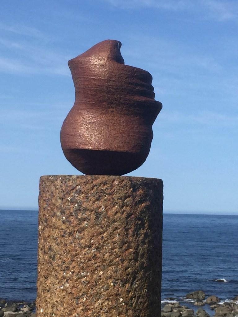
We had a chilled morning after that, and then packed up the van and drove to Eggum, to see the beach and the famous Eggum head. This is a famous art sculpture, and quite unique. It is located half a mile down a track on a remote spot overlooking the sea. As you approach it it looks like a man’s head looking out to sea. As you walk around it, it appears to change so that the man’s head is upside down! You need to see it to appreciate it!

From Eggum we went to Ustad beach, but didn’t stop as we weren’t that impressed. We had also visited Grimsoy beaches, but were unable to find anywhere to park, so admired them as we drove past. There were many coves of deserted beaches with beautiful clear water and golden sands. The area around there is a lot more rural, with much farming.
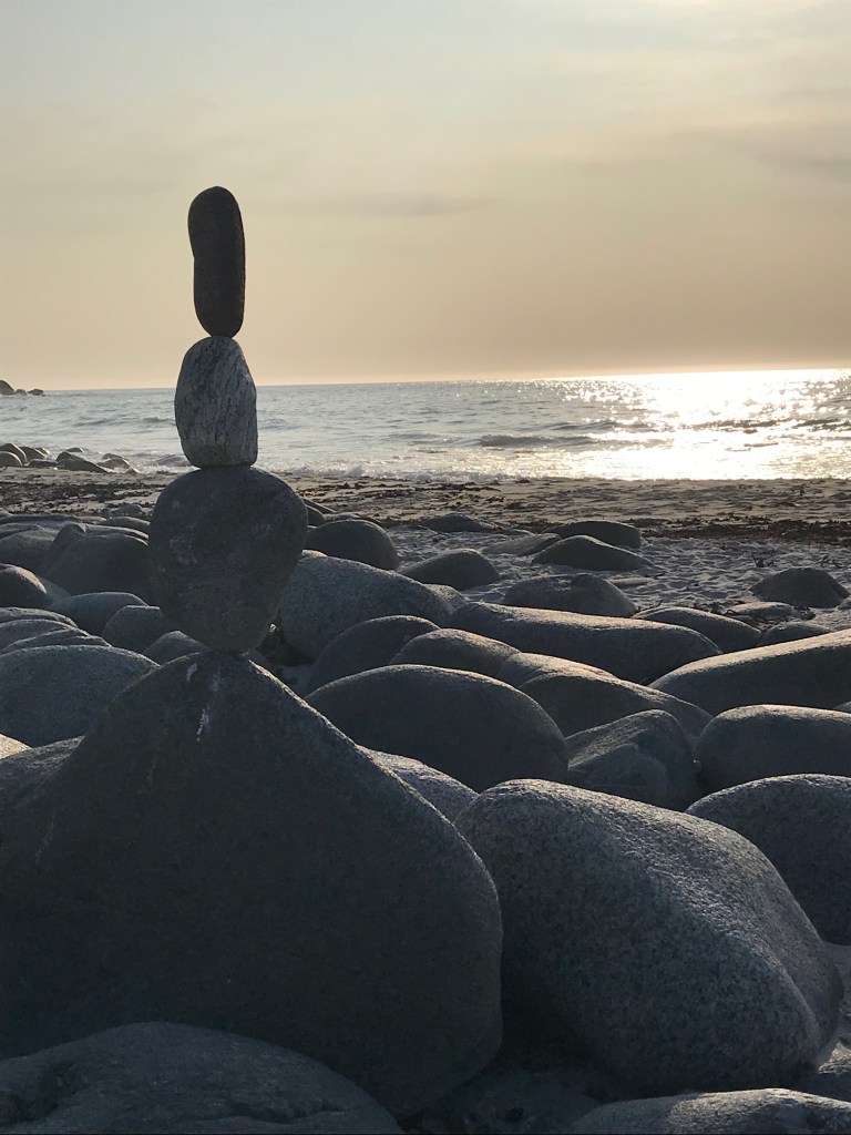
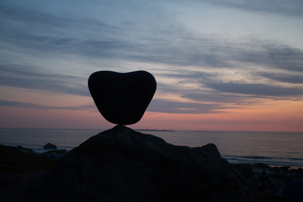
Yet again we hit the jackpot with Uttakleiv beach; somewhere Lyn had been determined to visit, and I can totally see why! Firstly we passed the lovely beaches of Haukland, but they looked busy, so we drove on to Uttakleiv, through another bendy tunnel. We had to pay 250 NOK to stay at the beach, but omg, it was worth every krone. I’m not going to say too much about it, and let the many photos speak for themselves!
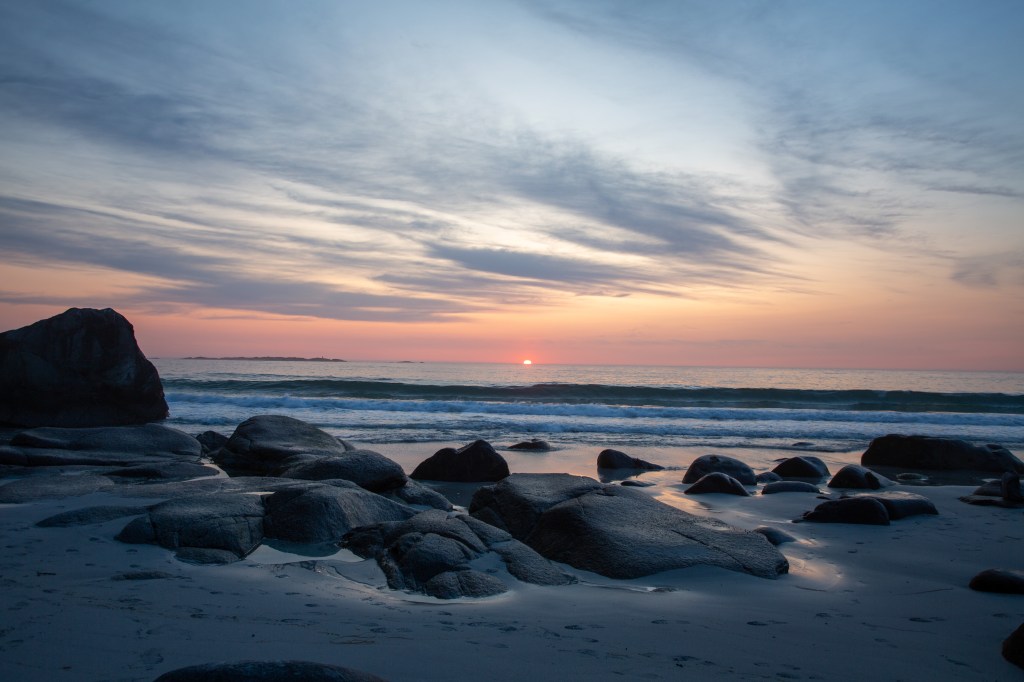
This beach has many balanced rocks on it, which I love.
It’s the first beach we’ve seen so far with crashing waves, and yet it still manages to have crystal clear water and that amazing blue colour. We went for a walk along it, and then tried to find the infamous Dragon’s Eye which we had seen in arty photographic shots of the beach. Lyn analysed the photos, and together we were able to line up some rocks in the photos that lined up to point us to the dragon’s eye….. a round rock in a pool of water. We took many photos, and surprised the two ladies sitting right by it by chance, who had never heard of it. They were soon taking photos too! See if you can see him looking at you!

We went back onto the beach to watch the sun go down and take more photos. There were many people camping on the beach, and we all congregated quietly to watch the sun retreat. It’s lovely how it brings people together all around the world.

Leave a comment